
Teledyne Optech Makes High-Density Lidar Mapping Possible in Portugal
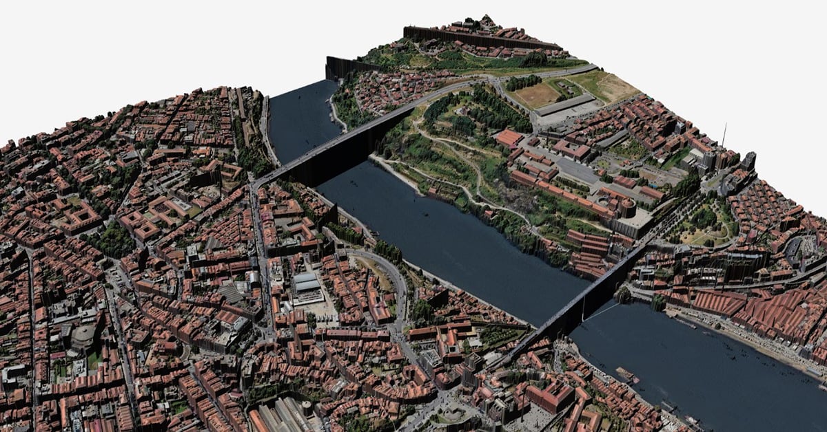
Earlier this year, industry partner STI Group collaborated with the Portuguese Directorate-General for Territory (DGT) to launch Portugal’s first-ever nationwide, high-density Lidar mapping program. The goal of a detailed public dataset would allow government and private sector specialists to better plan projects and make more informed decisions regarding the country’s future.
However, the ambitious initiative faced challenges with the convergence of limited resources, complex terrain, and lack of experience with a Lidar program of this scale. The heavily forested country, with its steep coastal cliffs and mountain ranges, was difficult to fully cover even with the best conditions. Weather in the region is also temperamental, with storms and power losses causing interruptions.
The obstacles facing Portugal’s mapping initiative were exactly the kinds of customer issues that Teledyne Optech’s product and engineering teams had been working to address. While other industry providers typically focus solely on developing next-generation Lidar hardware, Optech took a different approach. Looking at the common customer challenges of long delays between data collection and quality verification, the team created Onboard, an airborne Lidar solution designed to overcome the collection-to-confirmation gap without requiring customers to replace existing sensors.
“We're not trying to build technology just because it's possible. We're trying to understand the problems our customers face and find the best way to help them succeed,” explained Sammy Guergachi, Product Designer at Teledyne Optech. “It’s not always about coming out with a new sensor. It’s about understanding the customer’s problem and finding the best way to solve it.” The result is an option that is unique in the industry, giving customers the option to upgrade existing hardware and opening up new capabilities while simultaneously eliminating long-standing pain points.
"It's about understanding the customer's problem and finding the best way to solve it."
- Sammy Guergachi, Product Designer at Teledyne Optech
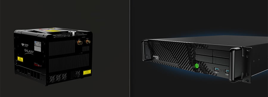
Teledyne Optech's Onboard and Galaxy systems, used together to successfully complete STI's Portugal mapping project
Instead of requiring a whole new sensor upgrade, Onboard works alongside a customer’s existing Lidar sensor as a high-performance computer that processes Lidar data in real time, providing immediate feedback to operators during a flight. It also generates reports and imagery that can be viewed anywhere during or immediately after a flight, a process that used to take days or weeks to turn around.
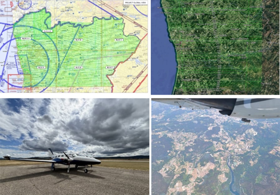
Flight path and photos of the aircraft used in STI's Portugal mapping project
Alongside the success of our partners STI, the Portugal mapping project is one of the strongest current examples of what Onboard can do for customers. Throughout the project, changing conditions threatened to affect data quality. The aircraft experienced turbulence, which often causes problems for accurate collection; in another instance, a power outage threatened to disrupt data delivery timelines. Onboard’s quality control capabilities allowed operators to quickly determine whether the data met requirements or needed to be re-collected, saving time and cost with much better-informed decisions. Because Onboard generated usable data immediately, STI was able to continue moving the project forward without waiting for extensive post-processing or re-flying the area.
Onboard’s ease of use also made the project possible. Operators have traditionally used complex software that takes a long time to master and creates knowledge gaps that are difficult to replace. By designing the operator experience from the ground up, operators can now be trained in a single day, reducing turnover risk and making projects more accessible and feasible.
STI and Portugal’s success is a fantastic example of how the Optech team’s philosophy of “doing things differently” in the Lidar industry translates into a whole new way of gathering data and running more efficient, economical, and successful mapping missions. For our teams, it proves that innovation doesn’t always mean building something new. It means seeking out feedback and understanding real-world challenges and then working together to solve them in meaningful ways.
Related Articles
-
 Case Study
PackBot is Top Dog in DHS SAVER Study
Read the Story -
 Use Case Scenario
Teledyne Supports NASA's Artemis II At Every Mission Stage
Read the Story -
 Case Study
Defense Brings the Power of Collaboration to National Robot Rodeo
Read the Story